

Integrating surveying, photogrammetric, and remote-sensing data to generate large-scale maps
1
Department of Geodesy, University of Agriculture in Krakow, Poland
2
Faculty of Environmental Engineering and Geodesy, University of Agriculture in Krakow, Poland
Submission date: 2024-01-27
Final revision date: 2024-03-26
Acceptance date: 2024-04-30
Publication date: 2025-06-16
Corresponding author
Archives of Civil Engineering 2025;71(2):37-50
KEYWORDS
TOPICS
ABSTRACT
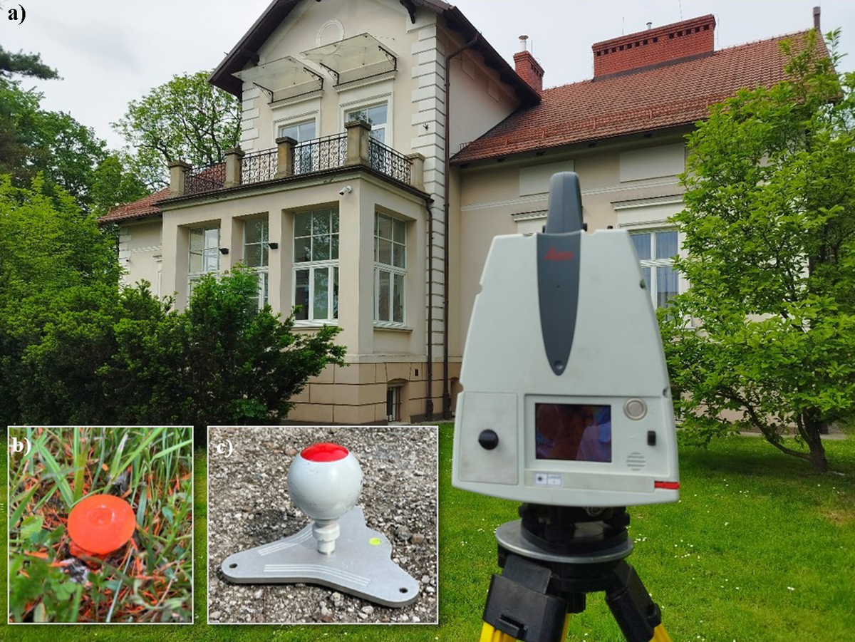
Integration means the combination of smaller elements into a coherent system that can function as a whole. In civil engineering, integration combines data from different sources to yield complete information about an object. Data synergy significantly helps consolidate all types of data while considering their content, quantity, and diversity of formats. It involves the removal of inconsistencies and redundant pieces of information from acquired data, resulting in a consistent image (dataset). A combination of survey data, maps, photogrammetry, and remote sensing gives a 3D spatial database. A holistic approach to object data acquisition with diverse methods, techniques, and measuring tools facilitates high-quality measurement results. Information acquired this way, supplemented with spatial data from official (state-controlled) surveying and cartographic resources, paves the way for generating large-scale maps, including the master map, in line with applicable legal and technical requirements. The paper describes the process of acquiring, processing, and integrating geospatial data of a specific structure and its surroundings, using point clouds from terrestrial laser scanning, an orthophoto, databases from the State Surveying and Cartographic Inventory, and classical tacheometric surveys and GNSS-RTK surveys.
Share
RELATED ARTICLE
| eISSN: | 2300-3103 |
| ISSN: | 1230-2945 |
We process personal data collected when visiting the website. The function of obtaining information about users and their behavior is carried out by voluntarily entered information in forms and saving cookies in end devices. Data, including cookies, are used to provide services, improve the user experience and to analyze the traffic in accordance with the Privacy policy. Data are also collected and processed by Google Analytics tool (more).
You can change cookies settings in your browser. Restricted use of cookies in the browser configuration may affect some functionalities of the website.
You can change cookies settings in your browser. Restricted use of cookies in the browser configuration may affect some functionalities of the website.